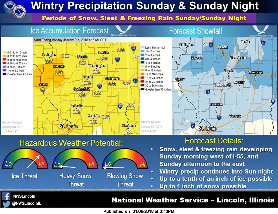
From the National Weather Service: A weather system will bring a wintry mix of precipitation to the area late tomorrow morning through Sunday night. Snowfall amounts look to be around an inch or less but the main concern will be with the threat for ice accumulations which are currently projected to be less than a tenth of an Sunday afternoon and Sunday night. Areas along and south of Interstate 70 may actually see temperatures rise above freezing tomorrow afternoon with mainly trace amounts of ice before the precipitation goes mainly over to rain. Elsewhere, surface temperatures are forecast to rise close to the freezing mark, but that won’t be until late Sunday afternoon or Sunday night. Until then, there will be some slick roadways across the area late Sunday morning through Sunday night as the snow develops initially, then mixes with or changes to sleet and freezing rain and continues through Sunday night. If you plan on traveling across the area, especially Sunday afternoon and evening, be alert for rapidly changing conditions with snow and ice covered roadways possible.
WINTER WEATHER ADVISORY IN EFFECT FROM NOON SUNDAY TO 6 AM CST MONDAY
The Decatur Radio App-The Latest News, Sports And Events In Your Hands


Listen Live


Weather

Decatur, IL, USA
53 °F Sunny